Wednesday 27th May, follow up thoughts
Learning more about Israel
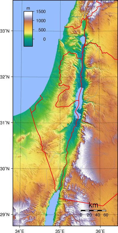
Present day Israel is virtually the same size as Wales, but it is long and narrow, approximately 290 miles long, and approximately 85 miles wide. This includes Judea and Samaria (the West Bank*). If we add the Golan Heights* it's slightly larger. 2.1% of the country is water, from the Sea of Galilee (top of map), the Dead Sea (middle), and the river Jordan (top to bottom).
You can see that there is a central spine of mountains where little will grow, with huge areas of desert to the east, and also below to the south dominated by the Judean and Negev deserts. The mountains cause fierce storms to rage down this "funnel", especially across the Sea of Galilee, so the Jews knew all about storms! However, there are fertile areas on the coastal plains, and it's one of the reasons that many countries coveted this land in the past.
You might want to look up another map to show the position of places like Jerusalem, Bethlehem, and Capernaum. A useful site for this is: https://bibleatlas.org/capernaum.htm
*The Golan Heights, the West Bank and East Jerusalem are part of territory disputed under international law.